You know that adage “a picture is worth a thousand words”? It sure applies to this one, saved from the archives of our good friend and fellow trekker, Steve. If you’ve read the earlier posts chronicling the trek up Whitney and my sister’s journey, you know that a few of those “thousand words” would be pain, nausea, and let’s get the hell out of here without falling to our deaths. But given sufficient time, the body heals itself and the mind slowly shifts all memory of the reasons you wanted to “get the hell out”, leaving a more prominent and permanent place for words like proud, self-confident, inspirational, adventuresome, hard-earned, and super cool. Good words for all of us.
The other day, Bev commented on the lack of posts about the Mt. Whitney hike and speculated that, even in the rear view mirror, the whole experience still felt too big to wrap our arms around it. As is so often the case, she summed it up perfectly. I’m also beginning to think that won’t change. So here goes. And be sure to check out the photo gallery (see links in the right sidebar).
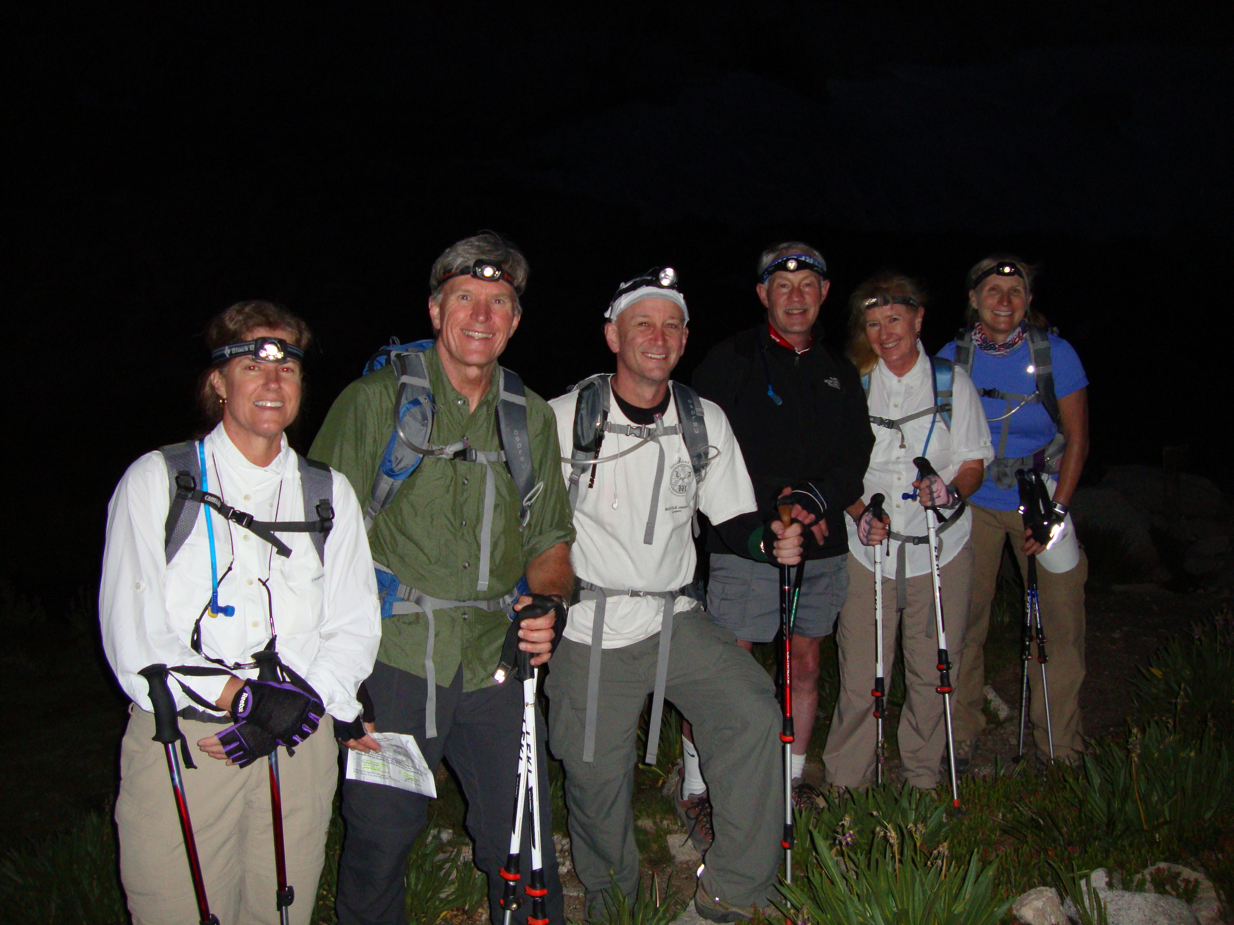
This is a story about six middle-aged adults, nearly all of them AARP eligible, who decided to hike the Mt. Whitney Trail in one day. This is not an ordinary hike. Permits are required and only available by lottery, held annually in March. The odds of “winning” a permit are slim. Permits are issued for dates from May through September. This year, the trail had snow on it in late-August and was not accessible to the summit until late-July. Except for the first two miles of hard packed dirt, the terrain is rock. All rock. Nothing but rock. The trail is 11 miles long. Each way. When you get to the top, you turn around and walk back down for 11 miles. Because you start hiking at 2:00AM, much of the trail on the way back down will appear “new” since the first four-plus hours on the way up were in complete darkness, save for the piercing beam of your headlamp to keep you from stumbling to your death. The trail begins at an elevation of 8,200’, which is higher than any summit east of the Rocky Mountains. It ends at 14,494’. The term “thin air” takes on a new meaning.
There are also some basic rules to follow. You must carry your poop off of the mountain. That’s right – nothing gets left on the mountain, including poop. The US Forest Service supplied each of us with one “WAG (Waste Alleviation and Gelling) Bag”. Poop in the bag, carry it out, and dump it in the “Human Waste” bins at the trailhead. The Visitor Center, where you pick up your trail permit, has a display explaining how to poop in the bag.
Carry your permit with you at all times because a Ranger will materialize out of thin air and ask for it. Don’t eat protein above 12,000’ or your body will rebel. Never run out of water. The last water source is at 12,600’, which sounds pretty close to the summit but is really many horrible suck-filled miles from it.
It’s 2am and the normal people are sleeping. Our group is gathering at the trailhead in pitch black darkness. It’s completely quiet except for the occasional “holy crap, you’re blinding me with your headlamp”. Everyone is upbeat and feeling good.
The trail has several distinctly named sections. The portion we hiked during the first four hours probably has an official name. We called it “Dark”. We were thankful that we’d hiked the first 2.8 miles the day before, giving us a bit of confidence knowing the early terrain and some key landmarks before reaching the boundary of the Mt. Whitney Zone. This is where you could be fined one bazillion dollars if caught without your lottery-winning permit. I was a bit disappointed with the Whitney Zone entrance. I expected something like the desert toll booth in Blazing Saddles, operated by a US Forest Ranger. Or even one of those manually operated gate arms you see at remote border crossings.
Instead, there was a simple sign. It was still pretty cool. And I wanted to kiss that sign on the way back.
This was also a convenient location to go pee, due to the abundance of huge boulders that afforded the ladies some semblance of privacy. A few hours later, there was no such luxury and all modesty was abandoned. Once above the tree line there was no place to hide. It should also be mentioned that the altitude caused everyone to pee like racehorses. High altitude triggers an increase in heartbeat, breathing and urination. The low humidity and low air pressure at high altitudes also causes moisture from your skin and lungs to evaporate at a faster pace — and your body’s increased exertion requires even more water to keep it hydrated. So we all went often and, as Tom pointed out, he “had the stream of a twenty-year old”. Speaking for the men with aging prostates, it was like God said “I give this small reward to you older people who refuse to act your age”. Whatever. I’ll take what I can get.
Nowhere to hide in the daylight…
The early hours in total darkness were surprisingly peaceful. There was no moon, so the summer night sky was full of stars. It was just the first of many humbling reminders of how small we were on this enormous stage. Once we entered the Whitney Zone, the trail was in pretty rough shape due to a particularly harsh winter and it seemed to disappear for short stretches. This was a little disconcerting in the pitch black on a trail with steep drop-offs. The packed dirt trail of the first 2.8 miles was behind us and now it was rock. Endless rocks. Big rocks. Unstable rocks. I wondered about the force of nature required to create this landscape. There were a smattering of other middle-of-the-night hikers, but we didn’t see the steady stream that we were told would be on the trail. It turns out that most of those people were sleeping in the campgrounds. Then, we ran into Ranger Bob. Nobody knows where he came from (maybe he hid behind a big rock and stepped out to check permits as you approached his covert spot) but we were happy to see Ranger Bob and pepper him with questions about the trail ahead. We saw Ranger Bob again at the summit, where he seemed to appear out of thin air. Maybe he has a secret underground tunnel with an escalator. Most of all, we loved saying the words “Ranger Bob” because it sounds like a cartoon character.
Bev and Ranger Bob
Then, finally, four hours into the hike, dawn. It was like watching the sun come up while standing on the moon. I was pretty certain that we weren’t on the lunar surface because we weren’t floating around and I didn’t see any stray golf balls. The high point waaaay in the back is our destination.
We knew that there was still a long way to go, but when daylight breaks you see what’s ahead and wonder “how are we going to get THERE?” Being in the dark had its advantages. Soon after daybreak, we reached Trail Camp where a few of the overnighters were just waking up. Mt. Whitney also came into full view for the first time.
Immediately after Trail Camp, you reach another famously named section of the trail, the “Ninety-Nine Switchbacks”. When you complete the switchbacks on the way up, you are rewarded with spectacular scenery and a view of the summit that appears deceptively close. When you complete those same switchbacks on the way down, you want to scream “That’s the NINETY-NINTH GOD DAMNED MOTHER F***ING switchback”. At that point, you have only descended to 12,000’, have nearly eight more miles to hike, and all you want to do is curl up in a ball and cry. Like I said, this is no ordinary hike.
We strolled through camp and began the dreaded switchbacks, careful not to miss our last water source at 12,600’, which was where altitude sickness began to rear its ugly head. From this point on, some of us suffered a range of symptoms including headaches, nausea, shortness of breath, an unsteady gait, and mental lapses.
Pumping water – snow in the background
The switchbacks were a grind but with every switch, there was a breathtaking view. Literally. Breathing became a little more laborious with every hairpin turn. The trail wasn’t particularly perilous (yet), although it was a bit nerve wracking during a stretch that required cables to keep us from falling to our deaths. It also occurred to me that in a rock landscape, it would hurt a lot if you fell down. Tom would learn that first hand on the way back down, when altitude sickness caused him to repeatedly fall over onto very large rocks. Ouch. The switchbacks ended at a point called “The Junction”, where the Mt. Whitney Trail converges with the John Muir Trail.
It’s also the point where you cross over from the eastern side of the mountain range to the western side. Because we began this trek at 2AM and the sun was still warming up the eastern cliffs, the Junction also marked the line between toasty warm and freezing cold. Crossing over to the western side, we pulled our jackets on and headed into the cold wind for the last 2.3 miles to the summit. 2.3 miles isn’t particularly far, especially if you’ve already walked for 8.7 miles. Sadly, this was no ordinary 2.3 miles. In fact, it was the LONGEST 2.3 miles EVER. The hard and late winter took its toll on this portion of the trail. It was as if God played dice with giant boulders and forgot to pick up after himself. Portions of the trail completely vanished, buried under massive unstable rock piles. Then, as we picked our way through that mess, the trail would open up with the eastern side completely dropping off. These sections are called “the windows” because you can stand on the trail and “see” America to the east and the west with nothing blocking your view. It also meant that you were standing on a three-foot wide strip of rocks with nothing on either side to keep you from plummeting forever. Definitely a poo-in-the-pants moment. Two of them.
This was becoming a bad video game with no end in sight. Just as we finished the gauntlet of wobbly boulders without falling to our deaths, we came upon a three-foot deep snowfield on a steep mountainside. Really? A snowfield on August 28th? Less than a half-hour from the summit? Ugh. The “trail” was a narrow single track path, barely wide enough for one foot. Our trekking poles became ski poles, pushing us upwards. After a little bit of cross-country skiing without the convenience of skis, we knew that the summit was within reach. The air got noticeably thinner and we knew that we wouldn’t be able to stay at the top for very long.
The first trail to the summit of Mt. Whitney was completed on July 22, 1904. Four days later, the new trail had its first recorded death on Whitney. Having hiked the trail, Bryd Surby was struck and killed by lightning while eating lunch on the exposed summit. In response, work began on a stone hut that would become the Smithsonian Institution Shelter, completed in 1909. When that 102-year old stone hut came into view, I wanted to dash to the top. Unfortunately, someone had tied an aircraft carrier to my backpack, preventing me from breaking into a full sprint. Or a slow walk. It was more like a slow crawl to the summit. But when we got there, eight hours and fifteen minutes later, it was pretty damn spectacular.
Those clouds started to gather <insert theme from “Jaws”> and we became concerned about being on an exposed trail during a lightning storm. While other hikers were leisurely sunbathing on the summit, we were anxious to get out of there. Sign the book. Check. Take photos. Check. Now just turn around and hike the damn trail all over again.
It’s been over a week since we conquered Mt. Whitney, the highest summit in the Lower 48 United States and there’s a whole lot of stuff to write about. We did something that very few accomplish, climbing the entire Mt. Whitney Trail, 22 miles round trip, from 8,200’ to 14,497’ in one day. Many people ascend Whitney in two or more days, camping along the trail. Few attempt to do it in one day and for good reasons. The change in altitude is dramatic, the trail is rocky and difficult, and climbing the entire trail in one day requires starting in the middle of the night and, for many hikers, finishing in the dark. On the other hand, you don’t have to carry camping gear and sleep on the ground.
There are many stories, so this will be the first of a few that will likely follow as some of the memories crystalize.
My sister, Sheryl, has never been considered an athlete. Growing up, she was more likely to be called a book worm and probably dreaded Physical Education classes. For you readers under 30 years old, this is a historical reference to a time when schools required you to do things like push-ups, pull-ups, sit-ups, and jumping jacks. What are those? Oh, never mind. It involved more than shifting your numb butt in the chair and moving your thumbs. Anyways, until less than a year ago, Sheryl was a self-proclaimed couch potato and while she admired the feats of others, I doubt she ever pictured herself doing them. The other five members of our mini-expedition had completed marathons, double century bike rides (200 miles in one day), rock climbing, full and half Ironmans, and hundreds of other races. Sheryl might have last run a mile in 1978. Our mother was pretty certain that Sheryl would die on the mountain. I was betting against death but wasn’t quite sure if she was tough enough.
People have a long list of reasons for pushing their bodies to new extremes. Proving a point, exorcising demons, seeking a thrill, postponing death, and sharing the experience with a loved one are just a few. I don’t know what Sheryl’s reasons were for tackling such a huge goal, but I suspect that they included a little bit of all of these. Whatever it was that drove her, she would need a lot of it to prepare for this adventure. We knew that she had a PLAAAAN but with two weeks of business travel every month, it was hard for her to fit in all of the training. She hiked and squeezed in workouts wherever she could. We got to hike all around the San Francisco Bay while Sheryl was grinding away on a crappy hotel treadmill in Wichita.
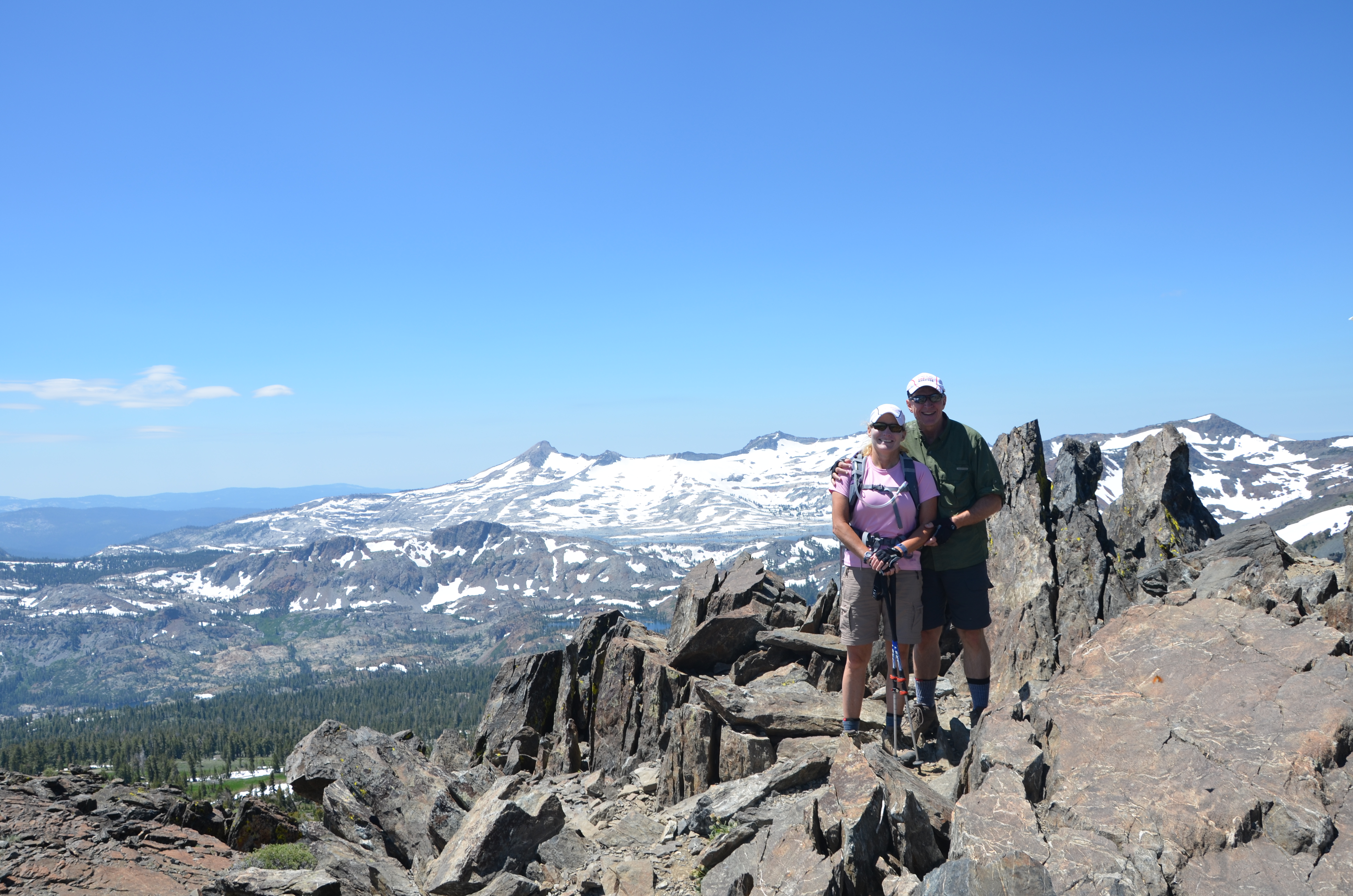
Our group of six embarked on Mt. Whitney Trail at 2:15am and were together for the first five hours before the terrain and pace split us into several groups. Bev and I regrouped with Tom on the summit and we were descending when we came across Sheryl, Laura, and Steve on their way up, about 30 minutes from the top. My brain was processing information slower than normal in the higher altitude, so I didn’t even recognize Sheryl leading them across a snowfield. Seeing my sister hiking through snow at 14,000′ with trekking poles and a backpack was simply bizarre. I might as well have sighted Santa’s workshop on the North Pole. Yet here she was, looking great, showing no signs of altitude sickness, and leading the others (who didn’t look nearly so perky) to the summit. I was proud and thoroughly confused. I’ll remember that moment for a long time. I’ll also remember her afterwards at the hotel, looking like she’d just taken a short stroll while most of us were still trying to remember where we left our legs.
In the end, everyone summited. Six went up and six came down. Nobody died. And my sister? No altitude sickness. No blisters. No issues. She’s damn tough enough.
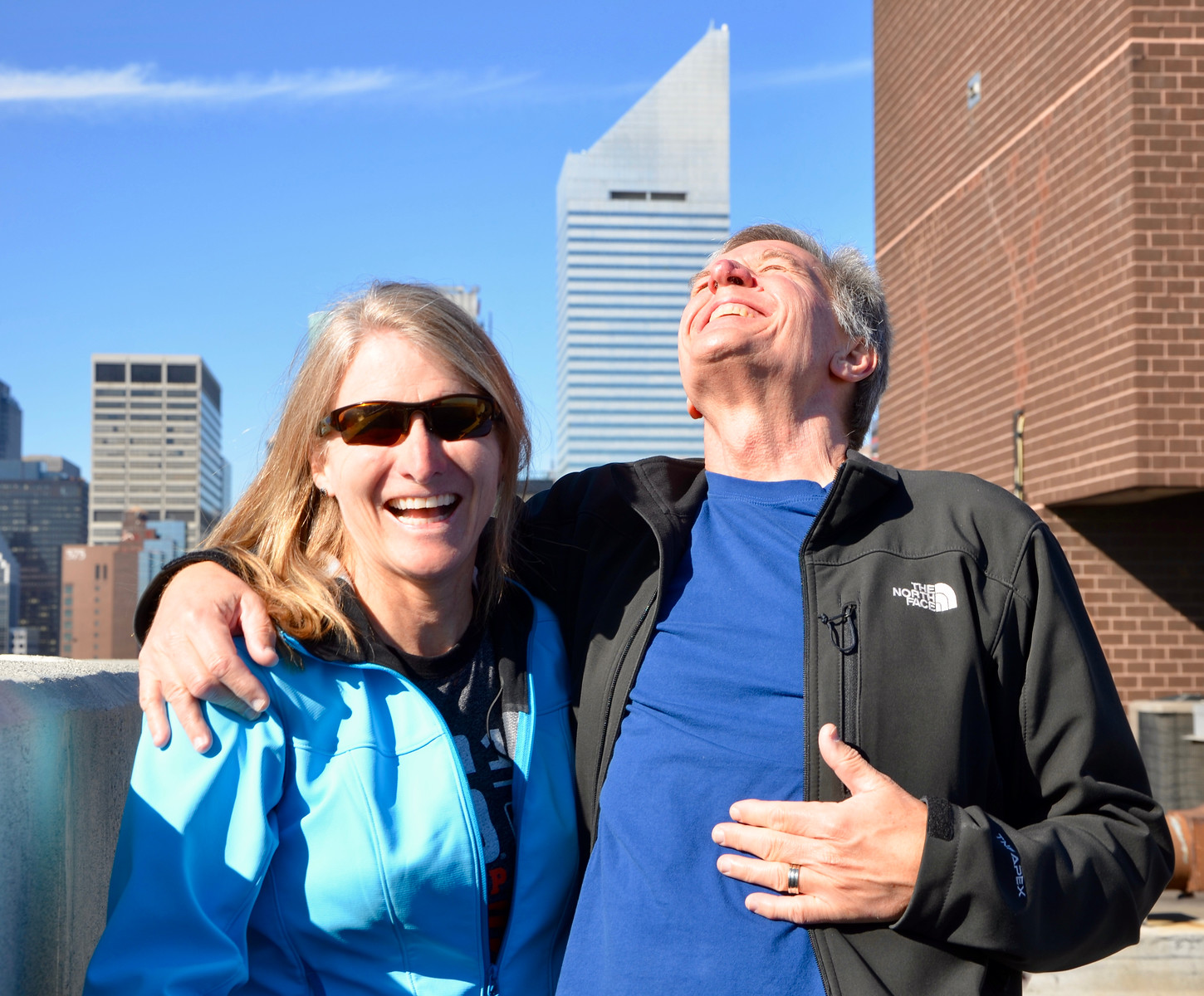
Another weekend, more high places. It was just a week ago we were hanging by ropes on the side of a very tall building in San Francisco and now we were hiking up Mt. Tallec, overlooking Lake Tahoe. This was our first attempt at high altitude hiking, even though the summit would “only” be 9,875′ above sea level. Our first experiment at hiking in thinner air was successful, although it was humbling when we realized that the summit of Mt. Kilimanjaro is exactly twice as high. Wow.
Because of the record snowfall this winter, a portion of the trail was impassable and we found ourselves scrambling up and down treacherous scree and large jagged rocks. Other stretches of the trail required hiking through the snow. Note that we were hiking on JULY 30th.
The hike was only 9 miles round trip but it was moderately strenuous and took us 6.5 hours, including time for photographs along the way and eating lunch at the top. It was a long day with 7 hours of driving and nearly that much in hiking, but it was worth the effort. We couldn’t have asked for a better day and the photographs tell the story better than anything we could describe here.
Brother-in-law Bob came to town for a day of hiking, eating pizza, and drinking beer. We took him out to Lake Chabot, where we hiked six or so miles. After stopping in one of the campgrounds to eat some Togos sandwiches, we did a little bit of butt model auditioning.
This was a twist on THE PLAHHHHHHHHN. Stretching the glutes and hamstrings and sending a message. This ass is NOT going to get kicked on Mt. Whitney.


 Brother-in-law Bob came to town for a day of hiking, eating pizza, and drinking beer. We took him out to Lake Chabot, where we hiked six or so miles. After stopping in one of the campgrounds to eat some Togos sandwiches, we did a little bit of butt model auditioning.